
The Dish Network User's Resource
The Dish Network User's Resource
Also see EchoStar 12 spot beam coverage as shown in a Cablevision publication (pdf courtesy of Bradtothebone on SatelliteGuys).
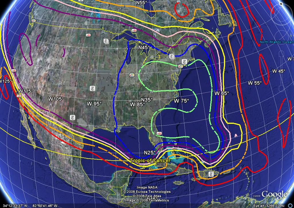
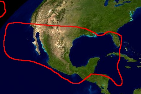
The following Maps are provided by Nelson61 at SatelliteGuys.US. (Used by Permission) Click on picture for full-size view.
 EchoStar 6 at 72.7°
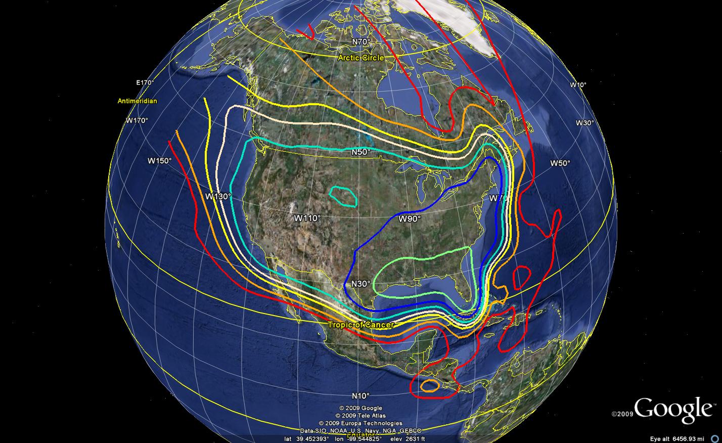 Nimiq 5 at 72.7°
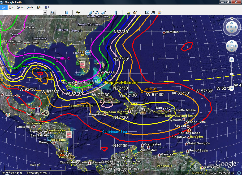
The following is a “guesstimate” of EchoStar 4's coverage from 77° before it was re-aimed to serve the US.
77° is a Mexican satellite location which has been granted authority to broadcast to the US.
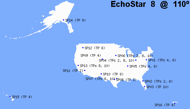
These pictures show the projected footprint of EchoStar 11 at 110° West Longitude.
The first picture shows the ConUS view. The bottom left shows the
Caribbean, and the bottom right shows the Alaska/Hawaii view.
Click on the picture for full size view.

The next set of maps Provided by James Long at DBSTalk (Used by Permission)
For a table listing individual spot beams at 119° and 110° complete with individual maps down to the county level visit James Long's web page
HERE.
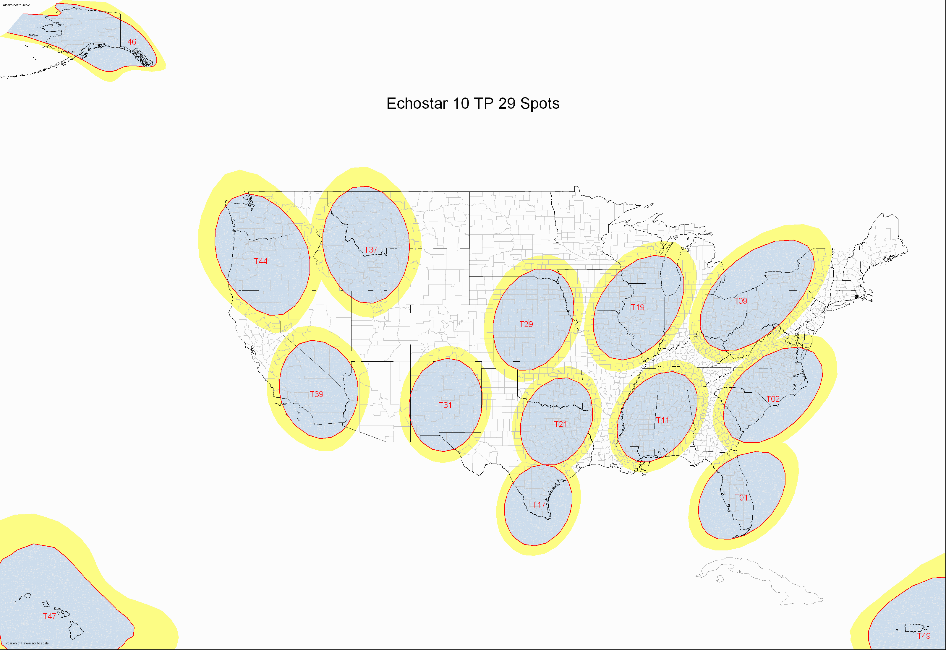
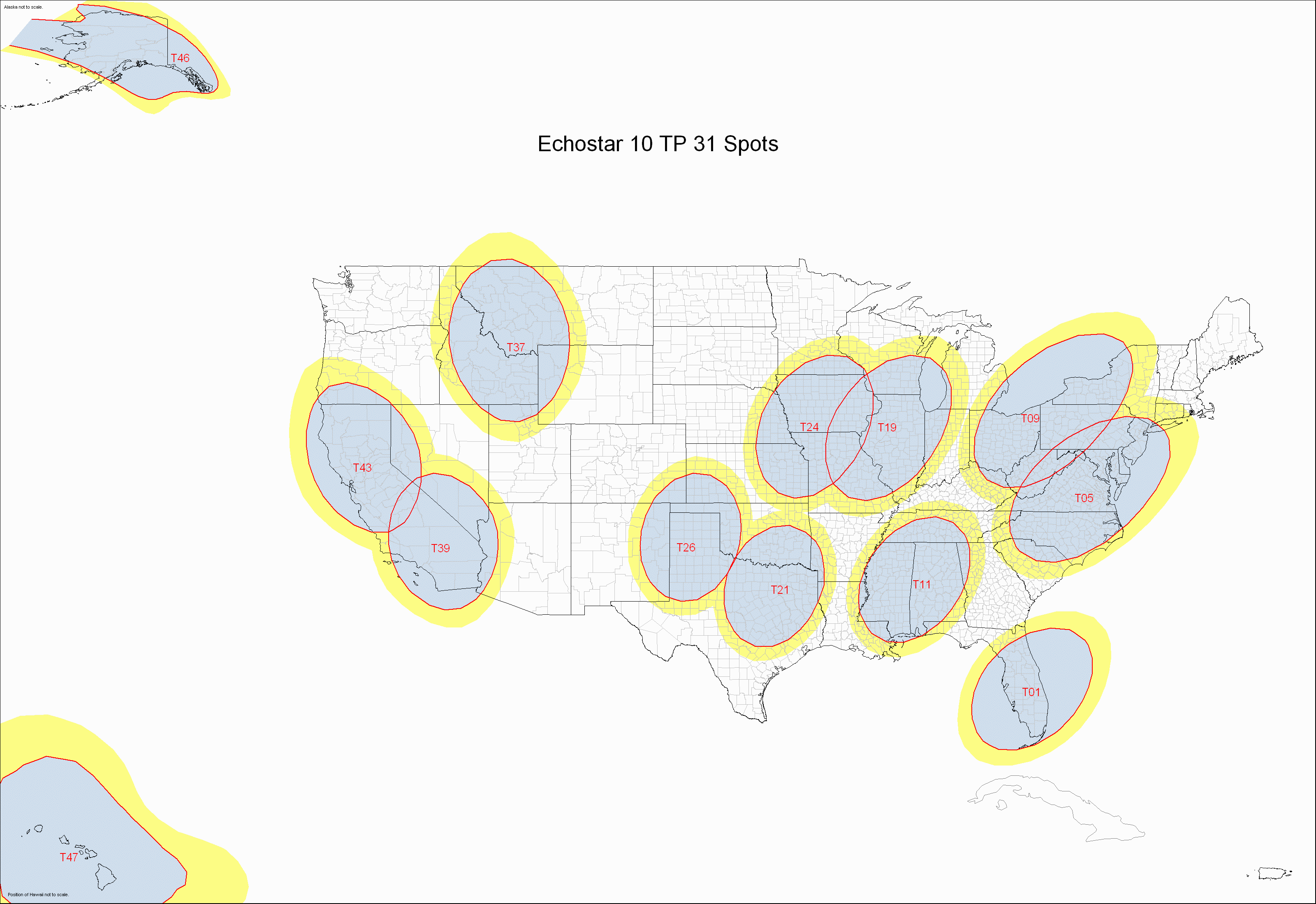
Some of these maps are linked below by transponder.
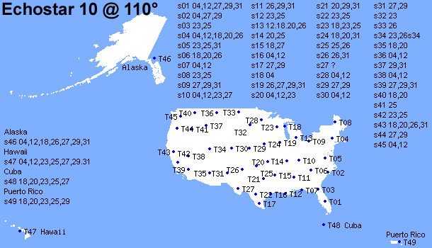
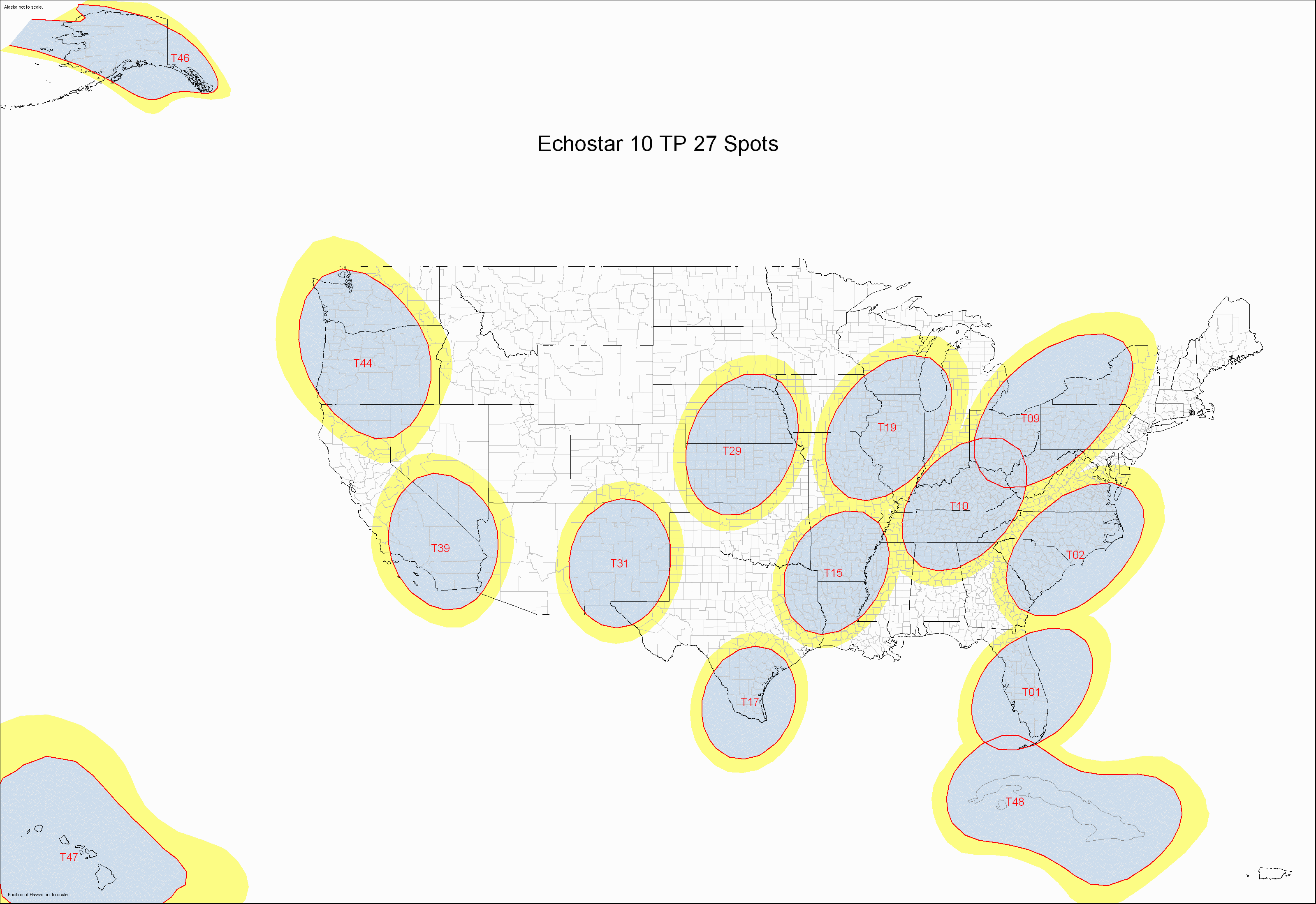
Take a closer look at the center points of the spot beams on EchoStar 10 HERE
Predicted useful signal area for spot beams on EchoStar 10 HERE - Continental US only HERE
| Larger and more detailed maps of E*10 spot beams provided by James Long at DBSTalk.com (Used by permission) The PDF files and requite Adobe Acrobat or Acrobat Reader. |
||
| Detailed complete national Spot Beam Map (PDF File) | Here | 359kb |
| National map with transponder 4 highlighted (PDF File) | Here | 356kb |
| National map with transponder 12 highlighted (PDF File) | Here | 620kb |
| National map with transponder 18 highlighted (PDF File) | Here | 337kb |
| National map with transponder 20 highlighted (PDF File) | Here | 341kb |
| National map with transponder 23 highlighted (PDF File) | Here | 351kb |
| National map with transponder 25 highlighted (PDF File) | Here | 350kb |
| National map with transponder 26 highlighted (PDF File) | Here | 367kb |
| National map with transponder 27 highlighted (GIF image) | Here | 285kb |
| National map with transponder 29 highlighted (GIF image) | Here | 289kb |
| National map with transponder 31 highlighted (GIF image) | Here | 270kb |
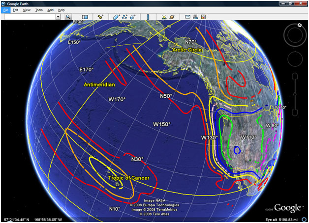
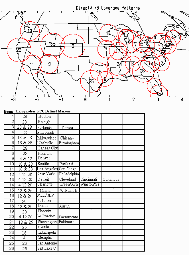
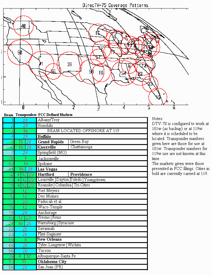
Take a look at the spot beams aimed at the continental US from both 110° and 119° HERE
The spot beam numbers are different than the maps linked at the bottom of the page, but they show a rough area where the signal is available from each spot beam for E*7, 8 and R1.
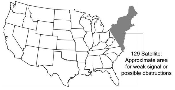
The current Ciel II satellite resolved reception problems in the Pacific northwest, southern Texas, and most of Florida. Customers in the NE states should expect reception problems and should instead be on Eastern Arc.
CONUS and Canada coverage maps)
The following map was sent to the EchoStar Knowledge Base via e-mail. The author of the e-mail requested the map be included on this page:
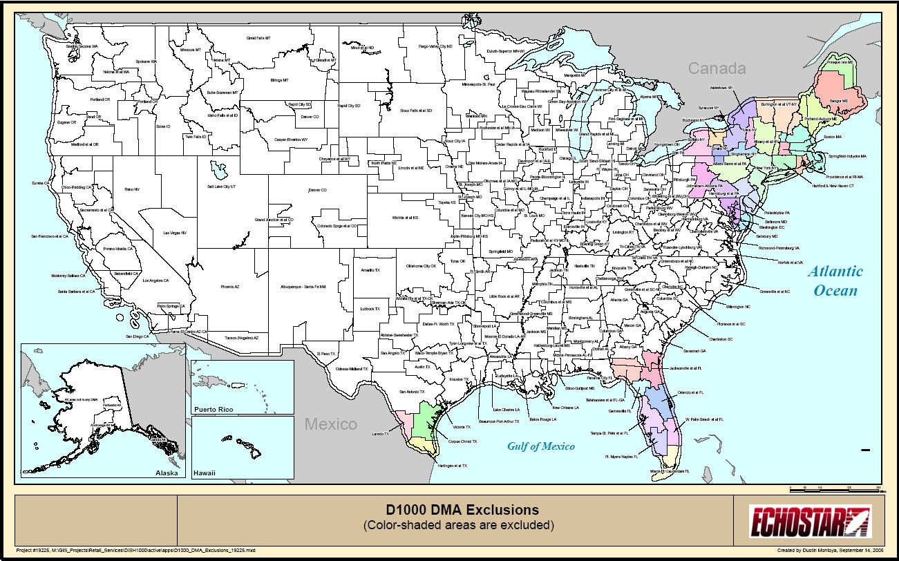
EchoStar 5 was replaced at 129° by Ciel II in February 2009, this map is now only of historical value. The shaded areas map indicate where a Dish 1000 could not be used. Alaska, Hawaii, Puerto Rico and the US Virgin Islands are not shaded, but it is assumed this was an oversight. Click on the map to see full sized map.
Taken from EchoStar's FCC filing requesting permission to move EchoStar 5 from 129° to 148°. Click for larger view.

The following is a mirror of Rabbi Bryan K. French's web site located at http://wvjw.info/dbs-beam/. Used by permission.
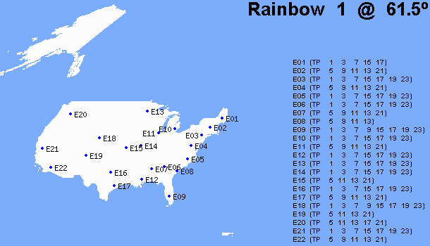
| 61.5w | R/L DBS-1 | |
| 72w | Nahuel-1 | |
| 101w | DirecTV-4S | |
| 110w | EchoStar-8 | |
| New EchoStar-1 | ||
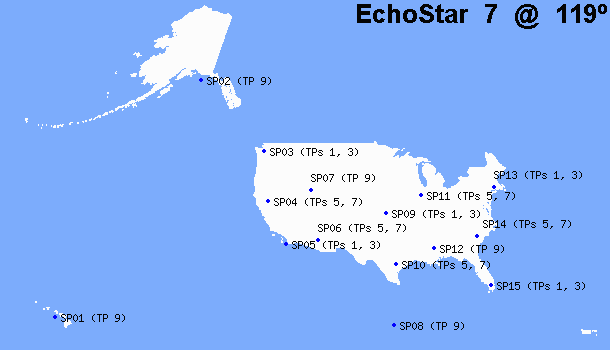
| 119w | EchoStar-7 | |
| DirecTV-7 | ||
| Launched/Active | In Construction | Planned/Never Built |